Jarseshwar
Note: Recently my friend visited this place on cycle. Gatekeepers did not allow him to enter on the Jarseshwar road. So please check before you plan this trail.
Jarseshwar is close to Pune yet largely unknown cycling destination. This is one of the destinations where you can cycle from Pune directly.
Jarseshwar is close to Pune yet largely unknown cycling destination. This is one of the destinations where you can cycle from Pune directly.
I preferred to carry my cycle in the car as I wanted to
explore more on the top instead of spending time in travelling till Jarseshwar.
To reach Jarseshwar you need to take Khadakwasla dam backwater road from NDA
gate. Keeping backwater at your left side, drive for 5-6 Kms and you will reach
at the gate of ‘Splendor County’. This is a famous farm house project in the area.
You can search simply for ‘Splendor County’ to know the route.
I parked my car on the road to Speldor Conty, just next to
the entrance gate. Gatekeepers there are much co-operative and they let me park
vehicle inside. Route to the Jarseshwar starts from ‘Speldor County’ road only.
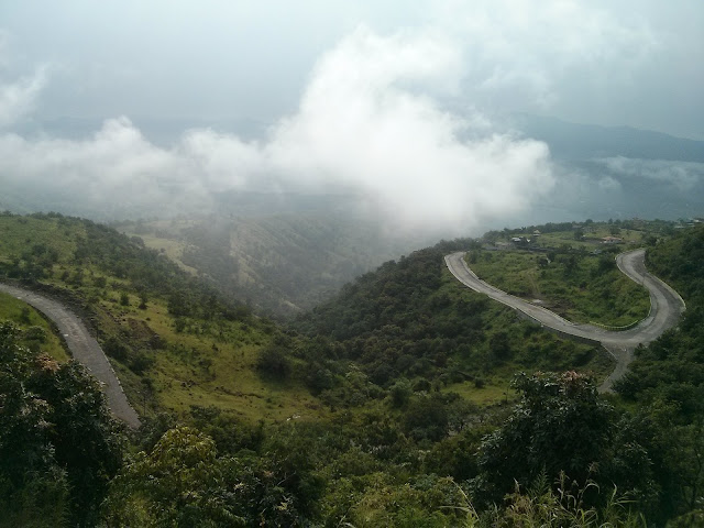
There is concrete road till top of the hill.
From very starting point of this uphill we get really
beautiful view of the Khadawasla backwaters and Singhad fort. Ride to top is long and pretty much stiff all the way. I underestimated height of the hill and
was exhausted by the time I reached top. Fortunately there is no traffic on
this road and there is beautiful surrounding all the way till top.
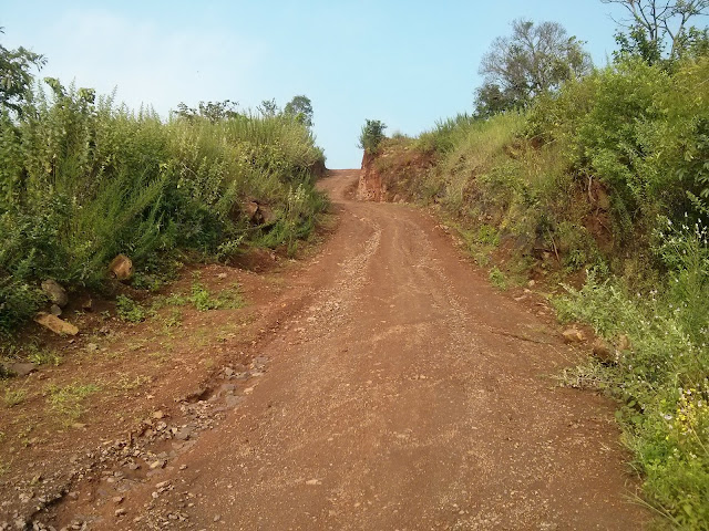
When concrete road ends at the top, there are mud roads
going to village. Take the road on your left which goes directly at Jarseshwar
temple and village. This village is situated right at top of the hill with a
beautiful Jarseshware temple. From this point you get awesome view of the Sinhgad,
Torna and Rajgad forts. You can see Pune city, Pirangut and Bhugaon side as
well from this point. There are many mud trails on the top if someone wants to
try mountain biking activities. Same mud road that we took to reach the temple
continues till the next village which is few miles away from the top. Exploring
this trail can be fun!
Take road which goes from left of the village and you’ll
reach a small water lake which supplies drinking water to Jarseshwar village.
There is no tar road till the village, but behind the
village you’ll find Helipad J
I took some mud trail from the lake instead of going back via
same route, and this trail took me through dense tree cover with nice mud trail
downhill. At one point after exploring I found this road connecting to one of
the concrete road build by Spendor County. Downhill on this road was really
fun, I reach max 45Km/Hr speed on this downhill.
This is a trail for both road bikers and mountain bikers. If
someone wants to try only mountain biking then I recommend carrying cycle till
top of the hill in your car and then start exploring various trails on the top.
Track details
Courtesy: Gopi Kori
Created by Google My Tracks on Android
Name: Jarsheshwar
Activity type: biking
Description: -
Total distance: 51.98 km (32.3 mi)
Total time: 4:13:20
Moving time: 3:38:37
Average speed: 12.31 km/h (7.7 mi/h)
Average moving speed: 14.27 km/h (8.9 mi/h)
Max speed: 43.87 km/h (27.3 mi/h)
Average pace: 4:52 min/km (7:51 min/mi)
Average moving pace: 4:12 min/km (6:46 min/mi)
Fastest pace: 1:22 min/km (2:12 min/mi)
Max elevation: 926 m (3038 ft)
Min elevation: 494 m (1621 ft)
Elevation gain: 864 m (2835 ft)
Max grade: 19 %
Min grade: -15 %
Recorded: 7/12/2015 5:56 AM


Nice information! Probably this would be the first on internet about this place!
ReplyDeleteWe did the trail today, starting from Khadakwasala. While coming downhill took a different route to Mandvi village. A challenging trail where there is no roads,just a track used by domestic animals..worth trying for hardcore adventure loving guys..
ReplyDeletegreat write up and thanks for detailed information sir. will try to do it one day.
ReplyDeleteGreat work Vikram! .. Keep it up. Nice writeup. Very useful information & great pics.
ReplyDeletemast
ReplyDeleteWill it be a good idea to explore this in monsoon? (Worried about the muddy roads :P )
ReplyDeleteDid anyone try?
All concrete road till top so it is good in monsoon. On top exploring further trails will be tough in this season.
Delete